
Mount Pleasant Previous Residents by Era
Evidence for previous residents is strongest when it is assembled as a dated stack. The Town’s assessment material gives a recent owner-of-record baseline. County land records can move the trail backward. Directories and local newspapers can then test whether a name is associated with the address or local area at a particular time. Each source has a separate coverage period and access route, so an absence in one does not erase a person from the historical record.
| Source | Years it covers | Where held | What it shows |
|---|---|---|---|
| Assessment roll and GIS | Roll PDFs 2012–2026; current GIS layer | Town Assessor and Westchester GIS | Dated owner-of-record, parcel, situs, mailing, and district clues. |
| WRO land records | 18th century to recent records advertised | Westchester County Clerk online account | Recorded-instrument and title-chain leads; online images are not certified copies. |
| Archives deed indexes | Deeds 1680–1907; mortgages 1680–1897 | Westchester County Archives | Earlier grantor/grantee and mortgage research paths. |
| Local newspapers | Valhalla Voice 1901–1980 | Mount Pleasant Public Library digital archive | Dated notices, obituaries, social items, and property references. |
| Directory reels | Turner 1904–1905, 1905, 1907; Richmond 1913, 1915, 1916–1917 | FamilySearch Library microfilm | Printed names, postal localities, and address-section leads. |
| Selected-name directory | 1885–1893 | New York Public Library microform | Trow suburban-town entries, with a selected-name limit. |
| Westchester Herald | 1834–1857 | Chronicling America record | Weekly Mount Pleasant/Village of Sing Sing newspaper context. |
Begin with the assessment or GIS baseline for a recent question. For a nineteenth-century address, begin with the deed index and maps, then bring in the newspaper and probate evidence. The Herald’s office was destroyed by fire in 1856, so an incomplete run should be treated as a survival issue, not proof that an event did not occur.
Mount Pleasant Previous Residents Start With a Parcel
Normalize the number, street, unit, postal city, ZIP, hamlet or village label, and search date before looking for past residents. Then use the Westchester GIS Experience to obtain the SBL and print key. The situs fields, including PROPADDRESS, PROPAPT, PROPCITY, and PROPZIP, describe the parcel. The owner fields, including OWNERNAME and OWNERADDRESS, describe a recorded ownership and mailing relationship. A mailing address can be in another place or belong to a trust, business, or agent, so it does not establish residence.
The Town’s Assessor posts roll PDFs for 2012 through 2026 and provides property cards on a public computer at 1 Town Hall Plaza. Use the same SBL in each yearly roll and record the roll year beside the current owner name and property location. The roll is an assessment snapshot, not a full list of people who lived there. The tax portal can corroborate a bill relationship by name/address or section/block/lot, but a payer or mortgage servicer may also differ from the occupant.
Note: Keep the parcel’s situs and owner-mailing fields separate so that a mailing record is never treated as a residence claim.
Mount Pleasant Deed Chain Through Time
The deed chain follows title, not every past household. Westchester Records Online, or WRO, advertises Land Records, Legal Records, and Maps, with free public index searching and account registration for images or reports. The land-search interface did not yield a reliable field schema during inspection. Use its live land-record modes and the actual labels displayed by the portal, rather than assuming a particular field, document menu, or date control.
- Capture the present owner-of-record, SBL, print key, and any legal-description clue from the GIS and assessment material.
- Find the instrument that brought that person or entity into title, preserving the recording date and document number if displayed.
- Identify the earlier grantor, then look for that party’s prior acquisition as a grantee. Repeat one instrument at a time.
- Carry the legal description, map number, or parcel clue across each step, because an old document may not use the modern street number.
- When the online route is incomplete, move to the County Clerk counter or the County Archives indexes for the older record span.
- Grantor and grantee
- The grantor transfers an interest in a recorded instrument; the grantee receives it. Their roles do not establish who lived at the address.
- Chain of title
- A sequence of recorded transfers that connects a current title interest to earlier instruments.
- Legal description
- The land description in a recorded document, such as a lot, map, metes-and-bounds, or other parcel reference that can outlast a street number.
The Westchester County Clerk’s Land Records office is at 110 Dr Martin Luther King Jr Blvd, White Plains, NY 10601, and its direct number is 914-995-3075. A certified Clerk copy is the authoritative copy for a legal purpose.
WRO and Certified Mount Pleasant Records
WRO is valuable for a remote previous-residents trail, but it is not the same as the official Clerk record. The County explains that WRO is a separate database, is updated periodically, and does not guarantee completeness, currency, or accuracy. It also states that online images are not legally equivalent to certified County Clerk copies. That difference matters when a deed result will be used to resolve a title question instead of simply locating the next historical lead.
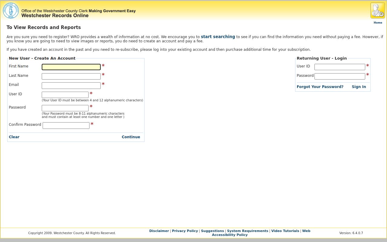
The WRO registration screen is shown below. A free account requires a first name, last name, email, user ID, password, and confirmation before image/report access where required.
For older research, the County Archives has deed grantor/grantee indexes from 1680 to 1907 and mortgage indexes from 1680 to 1897. Mail research costs $15 per individual-record search; custom work costs $25 per hour; copies after the first ten pages are 50 cents each. Payment is by U.S. check or money order before the work begins.
Mount Pleasant Address Directory Pairing
Once a deed places an ownership period, a directory or newspaper can add a dated household clue. The FamilySearch catalog identifies local White Plains-area reels: Turner’s directories for 1904–1905, 1905, and 1907, plus Richmond directories for 1913, 1915, and 1916–1917. These are microfilm resources at a FamilySearch Library, not a promise of a free online page viewer. Search both name and street sections where the volume provides them. A person may appear under initials, a spouse, widow notation, a business, or a neighboring postal place.
The Mount Pleasant Public Library local-history collection holds local newspapers, obituaries, maps, photographs, reference histories, genealogies, and subject files. Its newspaper archive includes Valhalla Voice from 1901 through 1980. Search a surname and street together, save the issue date and page, and inspect the page image because OCR can misread names. The separate Mount Pleasant city directory collections route holds the fuller directory shelf details.
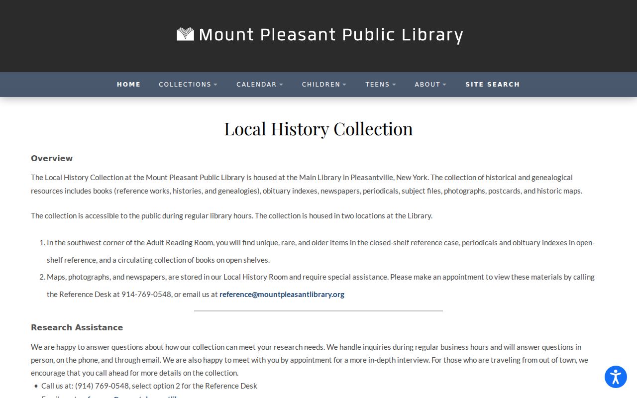
The library’s local-history resource is pictured below as a house-history companion to the recorded land trail.
Pair a directory year with the nearest public federal census, currently available through 1950 under the National Archives’ 72-year rule. Compare the enumeration date, spelling, township or village label, household relationship fields, and address carefully. A directory entry or census line can support a dated historical association; it does not replace the deed chain.
Address-to-household flow: parcel and SBL → dated deed period → directory or newspaper mention → nearest census or probate record → retained source date and page.
Old Maps for Mount Pleasant Addresses
Maps help when a deed’s legal description does not look like a modern address. The County Clerk Historical Maps collection samples property maps from 1793 to 1928 within a larger collection that reaches from the eighteenth century to the present. The 1848 Beekman Farm map, filed May 9, 1851 as map no. 456, identifies neighboring landowners, lots, roads, railroads, rivers, quarries, churches, cemeteries, and barns. Its value is geographic continuity, not a modern occupancy statement.
No dedicated Mount Pleasant, Pleasantville, Valhalla, Hawthorne, Thornwood, Sleepy Hollow, or Briarcliff Manor Sanborn volume was located in the Library of Congress search. Do not substitute a nearby town’s Sanborn sheet for a Mount Pleasant building history. Instead, compare the deed legal description, parcel shape, dated directory street index, map, and local-history files. No verified Town-wide street-renumbering or renaming table was located, so an older route, farm, hamlet, or owner label must be tested rather than guessed.
Mount Pleasant Change-Date Records
Building and certificate records can help date a structural change, but they do not identify every prior resident. The Town’s paperless service center began handling forms on July 1, 2026 and reports historical permit, payment, and inspection functions. Its direct interface was blocked during inspection, so no unverified fields or title-search controls are asserted. Ask for a Town parcel by address, SBL, permit type, and date range. A parcel inside a village may be held by that village’s building office instead.
The Town Clerk at One Town Hall Plaza is the FOIL Officer. New York Public Officers Law Article 6, sections 87 and 89, supplies the Town request route. The Town says that it acknowledges a request within five business days and may respond within up to 20 business days after acknowledgment. Letter-size copies cost 25 cents per page. A permit applicant, designer, or contractor is a document participant, not proof of residency.
Lawful Trails to Past Mount Pleasant Residents
A careful address history separates direct evidence from inference. A deed can show a title role, an assessment roll can show an owner-of-record for a specific year, and a directory or newspaper can connect a printed name to a date or place. A corporation, estate, trustee, or multiple family members named in a deed should remain identified by that role until another dated source supports a person-level conclusion. This approach keeps the record trail useful without overstating what it proves.
Lawful use. Use Mount Pleasant previous-residents research for personal, family, estate, historical, or property context, and never use a historical record to stalk, harass, or harm a living person.